Table of Contents
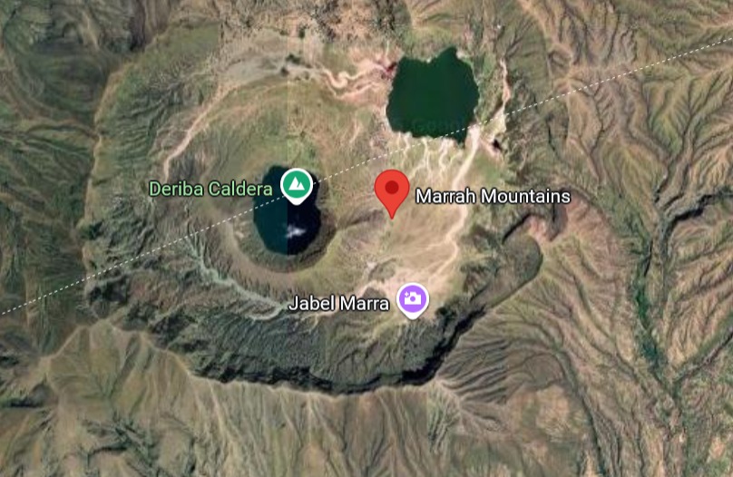
The devastating landslide in Surrein village, Mount Merra, highlights our fragility in the face of nature. In 2023, the warmest year on record, extreme weather events became more common. These events increase the risk of disasters like landslides, making a coordinated approach to prevention essential.
What does this have to do with climate change?
The Mount Merra tragedy may seem like an isolated natural event, but it actually bears the hallmarks of a larger global crisis: the climate crisis. Scientists have repeatedly warned that rising global temperatures are leading to radical changes in weather patterns. For Sudan, this doesn’t just mean increased drought in some areas; it also means that when rain does fall, it is more violent and intense than ever before. According to the State of the Global Climate 2024 report, 2023 was the warmest year in the 175-year observational record. The report also highlighted the massive economic and social upheavals from extreme weather and the long-term impacts of record ocean heat and sea-level rise.
This vulnerability is not unique to Sudan. The entire Greater Horn of Africa, a region already facing complex socio-economic challenges, is now on the front lines of the climate crisis. The region has experienced a significant increase in the frequency and intensity of extreme weather events, including flash floods and prolonged droughts. This shared regional challenge makes collaboration across borders, particularly in data sharing and early warning systems, not just beneficial but absolutely vital for protecting millions of people.
Climate change increases the atmosphere’s ability to carry water vapor, leading to concentrated, heavy rainfall in short periods. This “flash flood” rain saturates the soil on mountain slopes at a rate faster than it can absorb, greatly increasing the risk of landslides. What we witnessed, therefore, is not just a passing storm, but most likely a glimpse of a new climatic future that makes areas like Mount Merra more vulnerable than ever before, which makes the need for an effective warning and cooperation system more urgent.
The Role of the Sudanese Meteorological Authority (SMA): Observers of the Sky
Think of the Sudanese Meteorological Authority as the official “sky watcher” of our nation. Its primary and vital role is to monitor and forecast weather conditions. Its experts use advanced technologies to predict when and where heavy rainfall is likely to occur.
When they predict heavy rainfall—whether short and intense or prolonged they issue warnings. This information is the first crucial signal, serving as a wake-up call that danger may be imminent. However, their authority ends there. The Authority can tell us that a storm is coming, but it cannot assess the stability of a particular mountain slope or order people to evacuate their homes.
Shared Responsibility: The Chain of Survival
For the Authority’s warnings to save lives, other actors must be ready to act. A successful early warning system is a chain, and its strength depends on the strength of its weakest link.
- Geological Experts (Experts of the Earth): Sudan needs a strong and active geological survey authority. These are the experts who study the Earth itself. Their mission is to create hazard maps that identify which mountain slopes are composed of unstable soil and rock. This task is vital not only for Mount Merra. We must also remember that Sudan has other mountainous areas, such as the Red Sea Hills to the east and the Nuba Mountains to the south. These areas also feature rugged slopes and are increasingly exposed to the same extreme rainfall patterns caused by climate change. Therefore, a national hazard mapping program is essential to understand and prioritize risks in all our country’s vulnerable highland communities.
- The National Civil Defense Council (First Responders): This is the leading government agency in disaster management. Once the Meteorological Authority issues a weather warning for a high-risk area identified by geological surveys, the Civil Defense is responsible for communicating the specific danger to local communities. They are the ones who must issue evacuation orders and coordinate on-the-ground preparations and response efforts if necessary.
- Land Use and Planning Authorities (The Planners): In the long term, we must ask: Why are villages located in high-risk areas? The authorities responsible for urban and rural planning have a duty to regulate construction and settlement in areas identified as hazardous. Preventing people from building in the direct path of potential landslides is one of the most effective ways to save lives.
- Local Communities (The Last Link): Local residents are the most important part of the chain. Communities must be made aware of the risks they face. They must understand the warnings, know the evacuation routes, and participate in the development of local preparedness plans. A warning is useless if people do not know how to respond to it.
Moving Forward
The Mount Merra tragedy must not be in vain; it must be a powerful catalyst for change. The Meteorological Authority is doing its part by watching the skies, but it is now the responsibility of the government and civil society to connect the links in this chain of survival.
We need a formal, funded, and integrated national strategy for managing landslide risks. This means:
- Investing in geological mapping, empowering Civil Defense with the resources it needs, implementing smarter land use policies, and educating our communities.
- Leveraging Technology and Data: We must embrace modern technology to enhance our predictive capabilities. This includes using satellite imagery and Geographic Information Systems (GIS) to monitor land stability in real time, as well as developing advanced data models that integrate weather forecasts with geological data to provide more precise warnings.
- Fostering International and Regional Cooperation: Disasters do not respect borders. It is essential to collaborate with neighboring countries and international organizations to share best practices, exchange critical data, and coordinate response strategies. This collaborative spirit strengthens our collective resilience to the broader impacts of climate change.
Protecting our people is a shared responsibility, incumbent upon sky watchers, Earth experts, first responders, planners, and every citizen. Everyone must be prepared to play their part.

